Erosion on Long Island's South Shore Is Forcing Towns to Rethink Summer Layouts
Local authorities in Fire Island-adjacent communities are redrawing dune management and event permits as rising tides eat into public beaches.
By Julian Alvarez · December 10, 2025 · 5 min read
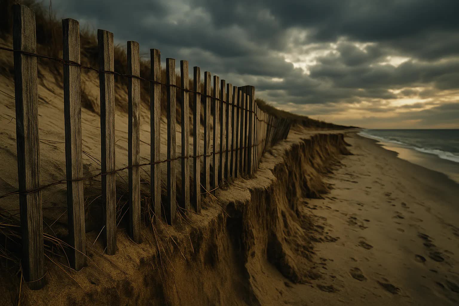
As New Yorkers plot their summer escapes from Brooklyn's Williamsburg and Manhattan's Lower East Side to the sand bars and ferry slips that serve Fire Island–adjacent communities, municipal planners and business owners say the traditional picture-postcard beach layout is disappearing, forcing a rethink of everything from dune management to where summer concerts and weddings can happen. Rising tides and chronic erosion along Long Island's South Shore have narrowed public beaches and pushed protective dunes closer to homes and boardwalks, prompting towns that depend on weekend visitors to redraw maps and rewrite event permits for the season ahead.
Local officials along the bayfronts of Bay Shore, Islip, Patchogue and the small municipalities that front Fire Island are hastily updating their beach-management playbooks. Boardwalks have been shifted inland in Ocean Beach and plans for movable dune systems are being piloted in Gilgo Beach. "We are not simply moving sand — we are moving expectations about what a summer on the South Shore looks like," said Ellen Marquez, director of coastal resilience for the Suffolk County South Shore Initiative, adding that committees are coordinating with ferry operators, business improvement districts and state agencies to smooth the transition.
The reconfiguration is already affecting the summer economy. Promoters who once booked beachfront stages for large concerts are trading sand for municipal lots on Main Street in Patchogue, and wedding planners are warning couples that seaside ceremonies in Bay Shore will likely be smaller or held further from the waterline. "We used to set up tables within sight of the tide; now we have to plan an event at least 30 feet inland or face a denied permit," said Tommy Russo, owner of the Sandbar Café in Bay Shore and president of the downtown merchants association. "Tourists from Brooklyn and Manhattan still want the beach vibe, but they won't get the same blanket of sand they remember from a decade ago."
Concrete numbers underscore the urgency. County surveys conducted this year show an average shoreline retreat of 3 to 5 feet per year at high-erosion points, with some hotspots losing up to 12 feet after major storms; Suffolk County estimates that more than 1,200 residential parcels on the South Shore are within 50 feet of the current high-tide line, and local governments have reduced large beach-event permits by roughly 40 percent compared with 2019. Suffolk County has set aside $42 million for dune renourishment and movable-protection pilot projects over the next three years, while federal hazard mitigation grants approved in late 2024 added another $15 million to shoreline work slated through 2027.
Planning teams are pursuing a mix of traditional and experimental defenses: sand-fencing and dune vegetation to rebuild natural buffers, periodic beach nourishment to replace washed-away sand, and modular fencing and wooden platforms that can be moved as the shoreline shifts. The New York State Department of Environmental Conservation is consulting with municipal departments of public works and the Fire Island National Seashore on permitting that balances habitat protection with public access. Officials say the new approach will require closer monitoring of sand volumes, new setback rules for temporary structures and standardized language in event permits about coastal change and liability.
Homeowners and environmental advocates are not always aligned on the best tools. In Kismet and Ocean Bay Park, some property owners have pushed for hardened seawalls and rock revetments to protect private property; conservation groups and several town planners caution that such hard structures can intensify beach loss downstream. "Seawalls often trade one problem for another further along the shore," said Dr. Aaron Feldman, a coastal geomorphologist at the Nassau Institute for Marine Studies, who has been advising town task forces. "Nature-based solutions are slower to show effects but more likely to preserve the recreational beach that both locals and New Yorkers expect to use."
Permit offices are adapting in practical ways that will be visible to summer visitors: organizers of festivals and scheduled concerts now must submit sand-management plans and contingency routes that push crowd gates at least 30 to 100 feet inland depending on the site. In Bay Shore, the permitting office has capped beach concert capacities at 1,200 people for shoreline-adjacent venues — down from 3,000 in peak years — and is requiring event insurance to explicitly cover tidal inundation. Ferry operators in Sayville and Bay Shore report adjusting dock schedules and adding temporary gangways to reach higher-elevation staging areas as temporary ramps are installed farther from the waterline.
The changes have ripple effects into New York City neighborhoods that supply the bulk of weekend visitors. Neighborhood groups in Williamsburg and the Lower East Side say the altered beach footprint is already changing transit patterns: more cars park in town lots rather than at hamlet docks, and some planned day-tripper routes to quieter Fire Island access points have been canceled as towns consolidate access at more sustainable sites. Coney Island and Rockaway remain separate focal points for city dwellers seeking a seaside day, but planners note that the draw of Long Island's quieter barrier beaches is shaping how summer crowds disperse across the region.
Funding and enforcement will be tests of the new approach. County and town officials say they are seeking additional federal resilience funds and private grants to pay for periodic nourishment and monitoring equipment such as drones and shoreline sensors; at the same time, municipal code enforcement officers face a heavier lift policing temporary structures that now must be sited farther inland. "We are trying to build a flexible playbook that can be updated annually as the shoreline moves," said Mayor Elena Ruiz of Bay Shore, noting a new intermunicipal task force that includes planners, police chiefs and business leaders. "The goal is to preserve access and commerce while recognizing that the beachfront of 2030 will not look like the beachfront of 2000."
Looking ahead, towns on the South Shore expect a cycle of incremental adjustments — from permit templates that expire each year to pilot projects that can be scaled up if they perform — and a summer calendar that will prioritize public safety and dune recovery. Planners say the next two summers will be decisive: if movable dunes, stricter setbacks and revised permit caps blunt the worst economic impacts while keeping beaches open to New Yorkers, the model could be extended across other parts of the region; if not, the landscape of summer on Long Island may require still more radical rethinking of how and where New Yorkers gather by the water.